Simplify. Analyze. Solve.
Timely information can be the difference between success and failure.
We specialize in simplifying diverse and difficult data, allowing you to see the complete picture faster.
3D mapping capabilities for displaying geospatial data
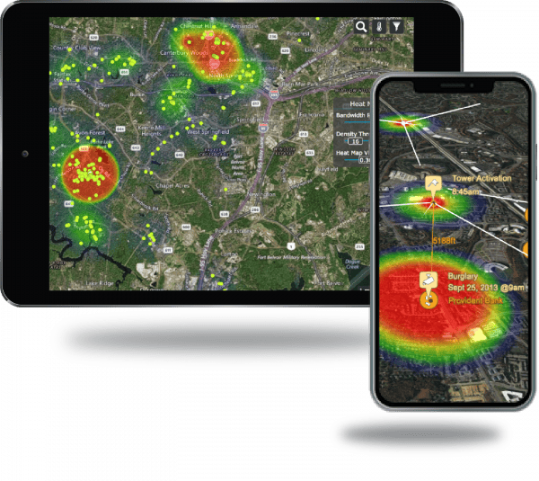
Visualize geospatial data for quick assessment
Utilize advanced tools for comprehensive analysis and reporting
Correlate data to identify known and unknown relationships
Make informed decisions based on factual information

SyncArena™ is a robust application with a simple and intuitive interface for mapping, filtering, and analyzing any geospatial data
SyncArena™ Works for You
SyncArena™ provides an end-to-end investigative platform, allowing the user to develop clear, actionable intelligence. Our patented synchronization technology enables analysis across data sources and completes your understanding of critical case details.
Triage Data
Drag and drop all source files into SyncArena™. The data is automatically synchronized and plotted on a single 3D map.
View Data Holistically
Evaluate data points from all sources in real time from a single window. Narrow your focus to key locations, time periods and filter out residual noise.
Track & Monitor POI
Monitor real-time activity of POIs on a 3D map using GPS tracks and cell phone ping data. Compare to historical data for more in-depth evaluation.
Recognize Patterns & Relationships
Discover previously unknown relationships. Predict behavior using pattern of life analysis tools.
Increase Efficiency
Files are automatically formatted prior to import, eliminating any manual steps.
Share Results
Publish professional reports for leadership. Create videos for more impactful presentations. Share projects with other jurisdictions.
Maximize the power of your Geospatial Data
Process data more efficiently and effectively with SyncArena™.
Local, State and Federal Law Enforcement
SyncArena™ benefits all levels of law enforcement. Currently used by Narcotics, Organized Crimes, Fugitives, Criminal Intelligence, Homicide, Robbery, Sex Crimes, and Patrol.
Analysts
Analysts rely on SyncArena™ to advance their investigative analysis. They can automatically import and time align data, highlight patterns and trends, identify and eliminate suspects and share their findings with others.
Detectives
Detectives complete a quick review of CDRs, ping, GPS, and other data so they can immediately assess the information and identify items needing further investigation and examination.
I cannot say enough about how great SyncArena is and I definitely recommend it
Crime Analyst
SyncArena™ in Action
SyncArena™ quickly imports and correlates data from multiple sources
and generates a visual narrative of events as they occurred.

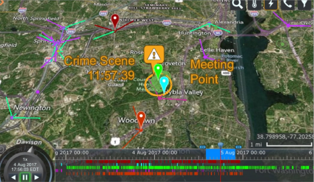
Sync Mode
Recreate a visual timeline of your target’s digital footprint using our patented technology. Know who was at the crime scene and where meetings took place.
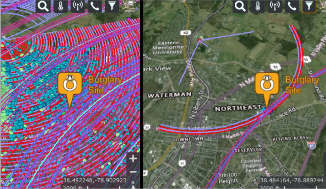
Advanced Filtering
Eliminate the noise and focus on your targets. Quickly filter by location and/or any other attributes to extract just what you need.


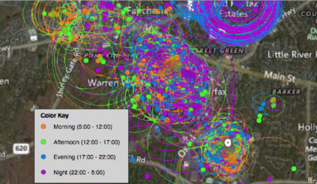
Pattern of Life
Quickly identify where your suspect is spending time by hour, day, or week. Organize data in various ways to identify patterns and trends.
SyncArena™ makes it easy
Work with us on your next case - our team will help you present a compelling case to your leadership and demonstrate how our solution aligns with your organization's needs.
No software to install
SyncArena™ works on all modern browsers.
Intuitive Interface
Simple to use. No expensive training.
Simple Pricing Model
Per user licensing includes all training and new features.
Frequently Asked Questions
Can I map Call Detail Records (CDRs) from different vendors and multiple suspects?
Yes, you can view all types of data from any number of vendors on one map and immediately see where your suspects are during an incident period.
Can small jurisdictions afford licenses?
Yes, we have multiple license packaging options designed for jurisdictions of all sizes. We have customers ranging from small town police departments to Federal organizations.
Can a detective map their own data?
Yes, SyncArena is easy to use and allows detectives to map their own data when their analysts are too busy or their department is too small for a dedicated analyst.
